MODIS optical images
The optical image layer in this version of IcySea consists of true color satellite images provided by NASA's Moderate Resolution Imaging Spectroradiometer (MODIS) instrument, which is mounted on the Aqua spacecraft. These images are essentially photographs taken from space and are updated daily. You can find more information about this sensor on the following webpages:
Image availability
In the case of cloudy conditions, the images will show clouds from above rather than the ocean, land, or sea ice. During the Polar night, the images will appear black. The annual coverage of optical images is shorter in regions located further north (Arctic) or south (Antarctic).
- Full Arctic coverage: March 30 to September 13.
- Complete coverage of the Northern Sea Route: March 3 to October 10.
- Complete coverage of the North West Passage: February 19 to October 21.
- Complete coverage of the seas around Svalbard: March 8 to October 4.
- Full coverage of the Antarctic ocean areas: September 5 to April 3.
Interpreting optical satellite images
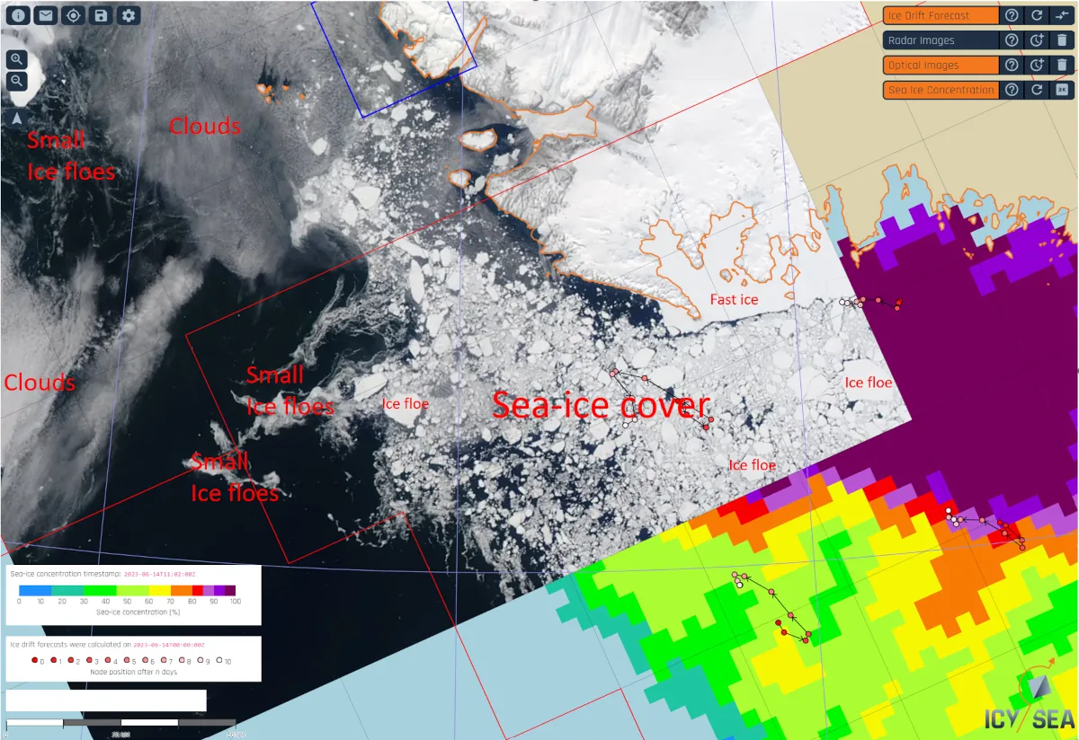
Interpreting true color optical satellite images is less complex compared to radar images because they depict what we would see with the human eye. Nevertheless, here are some guidelines and examples:
- Open ocean appears black on optical images.
- Larger ice floes are clearly visible when the image is
cloud-free (see example image with explanatory text below).

- Ice floes smaller than the sensor's resolution (250 m) are not depicted.
- Accumulations of smaller ice floes appear as smooth whitish
areas and can sometimes be mistaken for clouds.
- How can you distinguish fields of smaller ice floes from clouds? Unlike clouds, fields of smaller ice floes show ocean currents and often form longer snaky lineaments. However, this is not always the case, so if you're unsure, refer to the latest radar image, as clouds do not appear on radar images.
Age of an individual optical image tile
Important: When you click on the watch symbol next to the "Optical Images" layer button, you can see the age of an optical image tile. However, please note that the displayed age is not accurate, as the true image recording time is typically 3-12 hours older. Generally, MODIS images are updated daily and are never more than 24 hours old.