Data information and download sizes
IcySea is meant to be an actionable application and as such it makes the data available to the user in near real-time. In particular:
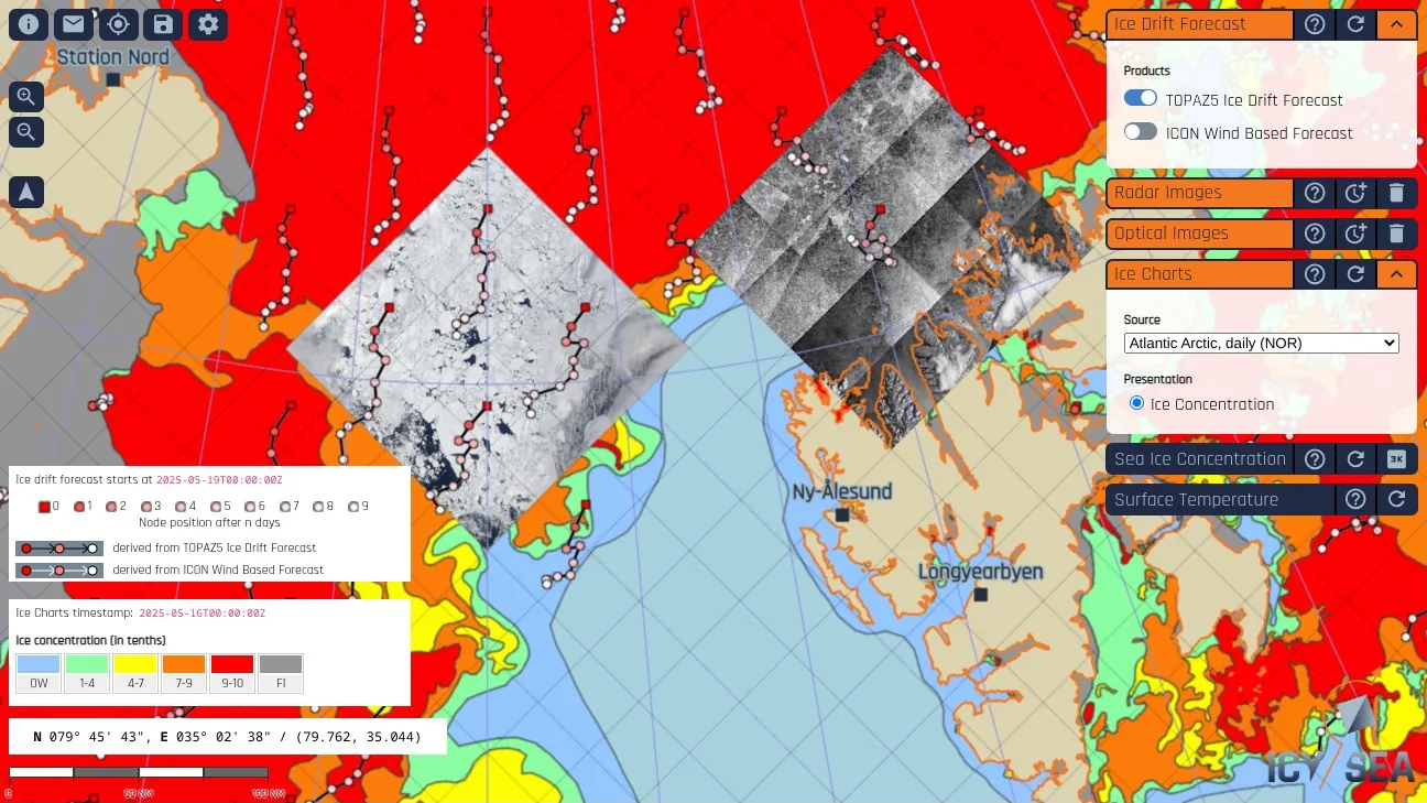
- Sea Ice Concentration (6 and 3 km resolution):
- Near real-time, up to 8 updates per day
- Ice Charts:
- US National Ice Center (USNIC): Weekly updates, Arctic-wide and Ross Sea, Antarctica
- Danish Meteorological Institute (DMI): Updates every 1-3 days, Greenland
- US National Weather Service (NWS): Daily updates, Alaska
- Canadian Ice Service (CIS): Daily and weekly updates, Canadian Waters
- Argentinian Naval Hydrographic Service (SHN): Weekly updates, Antarctic NAVAREA VI
- Norwegian Meteorological Institute (MetNo): Daily updates (week days), Atlantic sector of the Arctic and weekly updates, Antarctic NAVAREA VI
- Optimized Sea Ice Drift Forecast:
- Daily updates
- Radar images (Sentinel-1 and RADARSAT Constellation Mission):
- Near real-time, daily updates
- Optical images (MODIS):
- Daily updates
- Surface temperature:
- Daily updates
Approximate data usage information
When using a satellite data connection it is important to know how much data is transferred when installing and using the IcySea application. Below is a list of approximate data usage amounts for various aspects of the application:
| Information to download | Data transfer size |
|---|---|
| Application installation (v4.0.0) | ~21.4 MB |
| Sea-ice concentration | ~136 kB |
| Ice charts | ~15 MB |
| Ice drift forecast | ~176 kB |
| Radar Image low resolution tile | ~28 kB |
| Radar Image high resolution tile | ~1.7 MB |
| MODIS optical image | ~5 kB |
| Tile age information | 0 kB (information is computed in app) |